Tag Archives: Thomas Family History

BANGOR-HOUSE ON QUEEN’S

thomas story.jpg

It was just months ago, when I posted about a Quaker named Thomas Story. I have a copy of his 1st edition autobiography in my possession. Little did I know then, that our family’s starting point, believed to be the lands of John Thomas in York County Virginia, is documented to be Thomas Story’s first stop and the location of his first sermon in America. Information on Thomas Story from Wikipedia: “In November 1698 Story sailed for Pennsylvania, where, at the request of Penn, …was chosen the first recorder of Philadelphia by a charter of 25 Oct. 1701, was a member of the council of state, keeper of the great seal, master of the rolls, and in 1706 elected mayor of Philadelphia, but paid a fine of £20 for declining to serve.”

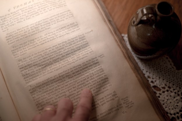
The following passages are from A Journal of the Life of Thomas Story:

Page 152. HAVING sailed through many and great Storms, variable and uncomfortable Weather, over most of the great Western Ocean, under the Protection of the divine Providence; and all the Ship’s Reckonings being out, on the 7th Day of the Twelfth Month, the next Day, about Four in the Evening, we Struck Ground with the Lead at nineteen Fathom Water.

THIS was glad Tidings to us all: and being in our Latitude we stood in towards the Land all Night, and the next Morning we saw the Capes on either Side of the Bay of Chesapeak, and were standing right in as could have desired; and that Afternoon we came to Anchor in Mockjack Bay, a little above Point Comfort.

ON the 11th of the Twelfth Month, about Sunrising, (the Seventh Day of the Week, and exceeding cold) we set sail in the Long-boat for Queen’s Creek in York River; but the Wind coming contrary, we, with one of the Men, went on Shore about two Miles below Gloucester, and went up thither on Foot, and Soon after went on board our Friend William Dowell’s Ship, lying at Anchor in that River, to write Letters for England; after which he sent some Hands in his Boat with us to Queen’s Creek, being about twenty Miles; and setting out about Eleven in the Night, and very cold, (being a hard Frost and Snow) it was troublesome to find the Entrance of the Creek; and, often running upon Oyster Banks and other Shoals, it proved very fatiguing and dangerous.

BUT thither at length we got, about Five in the Morning, vz. To the House of our Friend Edward Thomas at Bangor-house, but with some Difficulty after we landed; for our Men not knowing the Place, we went to Several other Plantations in the Woods before we found it. When we came to the House and called, Edward arose out of his Bed and came to us, concluding before, that we were Friends from England, (for he had had some Apprehension that Way in himself, a little before, but knew not who in particular) and he and all his Family made us kindly welcome; and having a good Bed provided, we rested comfortably till about Nine in the Morning. And our Friend Edward, being zealous for Truth, and the Good of his Neighbors, gave Notice of us, and of a Meeting to there that Day; where the Lord owned us, and gave us very comfortable Season of his Goodness with the Family and a few of the Neighborhood; who, though not Friends, were, Several of them, much tendered: which was the first Fruits of our Ministry in that County, and good Encouragement.

HERE we remained to refresh ourselves, and put out Things in Order till the 15th Day of the Month, and then had a Meeting about sixteen Miles off, at Daniel Akeburst’s, at Warwick River; which was a good Meeting, but small.

Page 164. THAT Evening we arrived at the Dock where the Ship was building, and lodged that Night with Captain Clayborn; and, next Day, had a Meeting at the Dock, near the Place; which was small, but comfortable; And, being weary with hard Travel, (but especially our Horses, for want of Food, or Forage) we determined to stay there till the First Day; and, intending another Meeting at the Dock, we gave notice of it to the Country.

WE had a Meeting accordingly, which was large and well; the People being generally sober, and several tendered, and after the Meeting, expressed their satisfaction; and some of Note among them said, “That since we had so good Things to publish, they were in hopes we would not finally leave those Parts “without more Meetings thereaway”; several of them adding, “That we should be welcome to their Houses, and the best Entertainment they had, though we had laid open their Priests to the lowest Capacities, and especially their Pseudo Baptism.

THE next Day, accompanied by Edward Thomas of Bangor-House, on Queen’s Creek, and his son, and some other Friends, who had come up, and given us their Company Some Days, we set forward for Queen’s Creek; but, in our Way, had much Thunder and Rain; and, though it was very dark in the Night in the Woods through the good Providence of God, we got well to that Journey’s End.

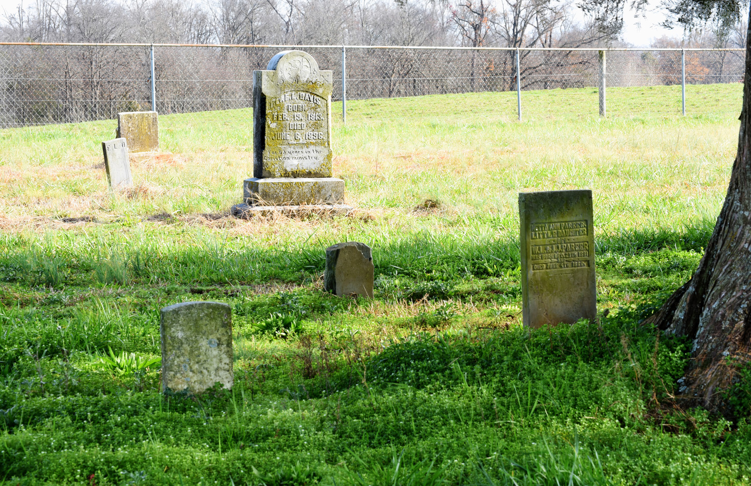
Edward was son of John Thomas who left a last will and testament in 1665 York County Virginia. From Thomas Story’s memoir, we know that John’s son, Edward Thomas, was prominently Quaker.

This took place at a time when there were very few Quaker ministers and meeting houses. Filling the void, Quakers met at the homes of respected elders where meetings were led by those called by God to do so.

The land owned by Edward Thomas can be traced back to John Thomas and his 1649 patent for 350 acres. This realization is credited to research contracted by Camp Peary. Expect much more in future posts.

book1

Journal of the Life of Thomas Story


JOHN THOMAS: A STARTING POINT IN VIRGINIA (PT. 1)

There’s a HUGE amount of research pertaining to the lands of John Thomas 1649 which now can be seen as not true. Ancestry , Geni, and other genealogy sites  are nothing more than thoughtless compilations of  what’s been wrongly said from the past. Furthermore, you may even see reference to following 8 pages of my research notes which in truth counters must of what’s been written.

Before using any of the following 8 pages of my working notes, please set aside time to read all sections in entirety.  If you have questions or concerns, feel free to contact me personally at geothos@bellsouth.net

_______________________________

We could start writing about John Thomas and his arrival in Virginia from any of many perspectives. But, as good fortune would have it, my first venture into this cause was initiated by David Queen whose knowledge and determination enabled a visit with Mark Kostro, Project Archaeologist for Colonial Williamsburg. Mark is likely the best qualified person in the region to address one of the top Thomas family mysteries.

But before moving forward, it should be pointed out that many questions can be asked about John Thomas ….when was he born, when did he arrive in the new world, and on board what ship did he sail? Was he one person, two different people, a father and son, man and cousin or nephew? And when did he marry and what was his life like following his sail to the new world? Did he make the trip once or many times? There is also question of his land holdings. Where did he first live and what later transactions are related to our ancestor versus the possibility of being confused with others of same name. And ultimately, what was the route of our ancestor out of Virginia into North Carolina where more modern records are increasingly available to search. Despite what anyone may say, the records on John Thomas do not collectively paint a clear picture. Much of what we know will be revisited in years to come and with that said, let’s now look at what’s traditionally believed to be the starting point for John Thomas in America.

Arriving sometime in the early years of the 17th century, it wasn’t until 1649 that a person by name of John Thomas is recorded as being granted land. A general location for the tract has been suggested for years by various family historians. Seeking clarity, and wanting to lay our eyes and hands on something tangible, arrangements were made for David and myself to meet with Mark who was well prepared. You’ll hear from Mark in a bit, but first look at the grant and transcription:

MicroFiche

To all & c. whereas & c. Now know ye that I, the said Sir William Berkely do with the consent of the council of State – accordingly give and grant unto John Thomas three hundred and fifty acres of land lying on the north side of Queen’s Creek and in the County of Yorke bounded vizt: north by west upon the land of Joseph Croshaw south by east upon Queen’s creek, west by south upon a little creek and swamp leading to the Indian cabin and east upon the by north land of M. Jernew, three hundred acres of the said land being granted formerly unto John Broach and by the said Broach assigned to Anthony Barckhurst and purchased of the said Barkurst by the said John Thomas and fifty acres the residue being deed unto ye sd John Thomas by and for the transportation of one person into the Colony whose name is in records mentioned under this patent to have and to hold & c yielding of which payment is to be made seven years after ye first ex. grant or sealing of the same & dated ye 4th 8ber 1649                                                    Dorothy Wife

 _____________________________________________

I cannot begin to write in detail about methodology and of how the above land was physically located. But, Edison H Thomas himself offers the following rationale and photo in his book “The Thomas and Bridges Story 1540-1840”:

“John Thomas and wife Dorothy settled on his 350 acres of land which was located near what is now the city of Williamsburg, Virginia. Today, it is a part of a military reservation and not accessible to the public. However, the general area can be plainly seen from a concrete bridge that carries State Road No. 132 across Queen’s Creek. The area lies on the east or right side of the creek as one looks upstream.”Thomas-Bridges story-59

This site is easily located on today’s landscape using an updated photo, a Google based map and Google interactive street view. And one note, of all the places on Queen’s creek to take a photo, the bridge crossing Hwy 132 offers the most representative view with the least amount of modern visual obstruction. As pointed out by David Queen, from any other vantage point, the appearance of a bridge upstream or down would detract from the image’s background.

Did Edison Thomas choose the photo location because he wanted readers to imagine the creek in John Thomas’ day and time …in the 1600’s? Was it a simple mistake or was there some other reason he located land in the secretive governmental base as being north of Hwy. 132?

Williamsburg archaeologist Mark Kostro, offered the following that both confirms and yet diverges from Edison Thomas’ take on the land. His assistance was very helpful in providing both historical context along with specific information pointing to another physical location. The impromptu presentation is in two parts, Make sure to see both!

So, as Mark Kostro clearly points out, archaeological research supported by historic record locates an early poor house on the land in question north and east of the Hwy 132 bridge. As Mark put it, John Thomas’ land is highly likely to not be the location previously portrayed. However, it does lie somewhere along the north side of the short run of Queen’s Creek. And from a previous study aimed at connecting original land holdings, it’s highly likely that John Thomas’s 350 acres does indeed lie on the grounds of the secretive base known as “The Farm” or officially, Camp Peary.

As offered in the presentation, and as based upon independent research from the past, John Thomas’ ca. 1649 grant of 350 acres is located within or near the green shaded area on the image below. Following the meeting at the Colonial Williamsburg Department of Archaeological Research, David Queen did not waste time and drove us to a public marina on W. Queen’s Drive. That location offered the best view north across Queen’s Creek towards Camp Peary and the lands once owned by John Thomas.

camp peary


DSC_2423

(top) Google image locating the John Thomas lands (in green) on Camp Peary along with location of marina and direction of viewpoint of the (bottom) photo looking across Queen’s Creek towards Camp Peary and the John Thomas lands.


In closing, I’d like to again express admiration and a sincere thanks to the efforts of both David Queen and Mark Kostro. I’d also like to express admiration for researchers such as Edison Thomas who made so much happen in a time when records were much more difficult to access. The takeaway for me is to tell the whole story. The background of how a story comes together is often as valuable and appreciated as much as the story itself. And with the same critical eye, we’ll need to move from this point to ask more questions. And for each one, we’ll need to base the answers from a large circle of possibilities, making sure to tell it all.

As for John Thomas’ land, was this the starting point for our many generations in America? Or, was this but a point along his journey south. Was this the land of our John Thomas or could it be the makings of history for someone else’s family? Our goal was to establish a clear starting point which we now have. It’s time to move forward and know that these are the challenges we will face. And please realize that new information will likely change your perspective of what you’ve just read.   Stay tuned!

RELIGION ON GOURDVINE: PART 2

DSC_4372
Staring across the grassy fields, I can imagine the goings on of early generations of settler. I’ve studied for years and feel in tune with their changing community and of the people who once lived near what is now the Edmond Davis cemetery. And realizing this was my ancestors’ final resting place, I know the story is not complete; there‘s more to be found and more story to be told.

Take a look at Edmond Davis cemetery … zoom in, zoom out and see the fields I see. The southeast corner of the cemetery is the place where my Thomas family is at rest. Edmond Davis and others are at rest under great cedars in the northern portion of the graveyard. And see the white spot midpoint of the west-most fence line?   That’s the resting place of Lorenzo Merriman Little, a member of Jesse James’ Gang who was on hand 13 Feb 1866 in Liberty Missouri for the first daylight bank robbery in the United States.  More on Edmond Davis cemetery can be found on Julie A. Hampton’ site.


W__Websites_Anson_Tif_Deed_000V0415.tif_doc.tifWhile putting together the title history for lands around the cemetery, I happened across the following deed (left) dated 1821 in which James Baucom conveys 100 acres along Gourdvine Creek to William Holly. The tract originated as part of a land grant entered 1797 and issued 1811 to Frederick Taylor. Though my next post will delve deeper into the title history of the surrounding area, this one deed opens the possibility that Edmond Davis cemetery was more than a family graveyard. As highlighted in yellow, there must have been a “Meeting House Ford” on the waters of Gourdvine and I can only imagine there was also a meeting house nearby.

This is new and big as it does not relate to any known church histories. Well over 10 years before the founding of Jerusalem Baptist and more than 30 years before the founding of Olive Branch Baptist, we now know another church existed in 1821. It’s not Rocky River Baptist as it’s too far away. Let’s look back at the grant, neighboring lands and later conveyances to see where this all fits in today’s landscape.

gourdvineIn the illustration to the left, the Edmond Davis estate lands and cemetery are identified as a red shaded area. Frederick Taylor’s 1811 grant for 300 acres is lined in blue and adjoins the lands of Richard Lee as is written in the warrant for survey. You’ll also note another tract granted to Jacob Gurley. It’s in that tract where I believe the “Meeting House Ford” once crossed Gourdvine creek. Here’s a short title history of the land originating in the Frederick Taylor grant:

Grant # 5982 to Frederick Taylor, Anson NC, ent. 20 Dec 1797, iss. 18 Dec 1811. Being 300 acres on both sides of Gourdvine Creek.

  • Deed O-187 Anson NC, 6 Aug 1808, John Jennings Sheriff to Richard Williams for debt owed to Solomon Steagall being the entire 300 acres.
  • Deed S-274 Anson NC, 26 Jan 1818, Richard Williams to Willis Williams being all of the tract lying west of Gourdvine Creek containing 200 acres. Wit: Isaac Williams, Jacob Little.
  • T-304 Anson NC, 26 Nov 1819, Isaac Williams to Obediah Curlee being all of the tract on lying on the east side of Gourdvine containing 100 acres. Wit: Isaac Williams, Jacob Little.
  • T-313 Anson NC, 2 Jan 1821, Obediah Curlee to James Baucom being all of the northern half of the tract above the dashed line containing 216 acres. Wit: Lewis Baucom, Ransom Baucom.
  • V-415 Anson NC, 24 Sep 1821, James Baucom to William Holly being all of the northern half of the 300 acre tract lying west of Gourdvine containing 116 acres. In this deed the northern most east-west line is identified as being above the “Meeting House Ford.” Wit: C. B. Curlee, William Mullis.

DSC_4423_4_5_tonemapped… above the Meeting House Ford. Hmmmm, … as water runs downhill, the ford should cross the creek within the adjoining tract downstream from the land originating in Frederick Taylor’s grant. Entered 1797 and issued 5 Dec 1805, Jacob Gurley received 100 acres adjoining Michael Austin’s lands on both sides of Gourdvine at the mouth of “Buck Branch.” Nobody today knows anything about Buck Branch though a branch does rise just below the cemetery before making its way to Gourdvine below Olive Branch road. Here’s a look at the conveyances of this piece of Jacob Gurley’s land:

  • L-195 Anson NC, 4 Mar 1805, Jacob Gurley to Isaac Williams Senr, being the 100 acres granted to Jacob Gurley. Wit: Willis Gurley, Isaac Williams.
  • V-92 Anson NC, 3 Apr 1822, James Baucom to Solomon Mullis, being 25 acres of Jacob Gurley’s 100 acres lying on the west side of Gourdvine. The deed states the land was conveyed from said Gurley to Isaac Williams Senr, then to Obediah Curlee and then to James Baucom. Wit: Obed. Curlee.
Olive Branch road passing over Gourdvine creek

Olive Branch road passing over Gourdvine creek

Where was the Meeting House ford located?  There’s very little option other than it crossing at the same location  as today’s bridge or at least very close nearby. And knowing the location of Meeting House ford in 1821, exactly where was the Meeting House?

It’s my belief that at some point from 1800-1820, a Baptist church was organized and built on the hills above Gourdvine creek. In 1821, at the time James Baucom purchased land from Obediah Curlee, the church and graveyard (now Edmond Davis cemetery) must have already begun to serve numerous families in the community.

As Baptists are social in order, survival of the church was dependent upon the clout and leadership of a few families. Something happened to this dynamic causing change. What could have happened?

Edmond Davis grave

Rev. Edmond Davis grave

We’ll never know for sure though the 1830’s and 40’s were hard. Migrations west carried away many and there was also disease and death. It’s important that my own David Thomas’ lands at least adjoined the cemetery and that he and his wife both died in the early 1850’s. Baptist minister and uncle Edmond Davis oversaw both the estate and orphaned children. In 1857, he bought David Thomas’s land that adjoined the cemetery. And then in 1858, Edmond Davis and others provided notification that Olive Branch Baptist church was to be built on Henry Baucom’s nearby lands. See Julie A Hampton’s site.

The church grew strong and Olive Branch as a community was formally incorporated in 1875. Though Olive Branch Baptist church had its own cemetery, the old graveyard by Gourdvine creek continues its service through today. Why has it survived and why did they name the new church Olive Branch? A sign, a branch of peace, there must have been a very real reason. It’s my belief the name was a way of bringing together a community that had been divided by death, migration or social conflict. It’s only a guess; it’s not meant for us to know for sure.

foreground - grave of Ananias Thomas, background -gave of Merriman Little, distant landscape - location of bridge and likely site of Meeting House ford.

foreground – grave of Ananias Thomas, background by fence -grave of Merriman Little,  distant low land – location of bridge and likely site of Meeting House ford.


RELIGION ON GOURDVINE: PART 1

The Edmond L. Davis cemetery is located on a hilltop just east of the bridge where Olive Branch road crosses Gourdvine Creek in Union county NC.

The Edmond L. Davis cemetery is located on a hilltop just east of the bridge where Olive Branch road crosses Gourdvine Creek in Union county NC.

I remember Thanksgiving weekend 1996 and a visit to the Edmond L. Davis cemetery in Union county to photograph family lands I had only recently learned about. It was dreary, cold to the bone, and yet the frequent sounds of gunshot rang out as hunting season was in full swing. My father had passed less than a year prior and here I was alone in a cemetery seeking to lay witness to my GGG grandfather Ananias Thomas’ grave. I found his hand-carved stone which appeared to be grouped in a plot amongst other members of Thomas family. And just behind his grave were two unmarked stones that some have identified as mere foot markers. However, it’s always been my belief the stones mark the resting places of my GG grandparents David Thomas and his wife Alice Newsome Thomas. David is the son of Ananias.

Both David Thomas and his father-in-law Joseph Newsome owned land along Gourdvine creek in the vicinity of present day Edmond L. Davis cemetery. Prior to his death ca. 1843, Joseph Newsome sold some of his land to David Thomas. Per bible record, Joseph’s daughter Alice Thomas died 3 Dec 1852 and Union county probate records indicate David Thomas died prior to 1855.

Lot 1 of the estate of Edmond L. Davis

Lot 1 of the estate of Edmond L. Davis

Following the death of David and Alice Thomas, Edmond Davis was appointed estate administrator . He was also named guardian of the younger children including my namesake ancestor George Thomas. In the Fall Term 1856 of the Court of Equity for Union County, C. M. McCauley ordered the sale of 268 acres. Known as lot 1 of the “land upon which David Thomas lived at the time of his death”, this tract was situated on the south side of Gourdvine Creek. It adjoined David Thomas’s second tract and the lands of Elbert W. Caraway and Edmond Davis. On 30 Dec 1856, Edmond L. Davis purchased the land for $1,325.

Important! Following Edmond Davis’ eventual death on 6 Jan 1896,  lot 1 of his own estate takes in the cemetery that now bears his name (see plat above) . The tract matches and therefore can be accurately located using county GIS land records.

historyofrockyri00broo_0073Edmond Lilly Davis was a prominent Baptist minister in a region historically dominated by Baptists. His life and services are well documented in E. M. Brook’s 1928 History of Rocky River Baptist Church. Edmond Davis was also a friend and brother in-law to David Thomas as he married Mary Elizabeth Newsome, a sister of David Thomas’ wife Alice.

Note that David Thomas owned 660 acres per the 1852 Union county tax list at a time when Edmond Davis was listed with less. Following the death of David Thomas, the numbers reverse with David’s ownership of course going to zero.   From this I’ve always wondered if the cemetery was built on lands that once belonged to David Thomas and/or his father-in-law Joseph Newsome? The following plat locates the entire estate of Edmond Davis. Note the portion highlighted in purple identifies the one lot Edmond Davis purchased from the estate of David Thomas.

davis2

Estate of Edmond L Davis

At this point, after nearly 20 years of looking, I still cannot say with absolute certainty that the graveyard in question was first located on David Thomas’ home land. But we know his lands were oh so close as were his father-in-law’s. And knowing there are no graves marking the resting place of David and Alice Thomas, my mind goes back to something Ms. Annie Lee Traywyck once told me: “The cemetery once had many more stones that eventually went the way of cows”.  And then there are the two stones behind those of Ananias and his wife Sarah.  Stake-like in form and made of a much harder granite, was there ever even clear writing on the stones? Is it just my wishful thinking? And note that Olive Branch Baptist Church just up the road was formed by Edmond Davis and others in 1858 just as the estate of David Thomas was being settled?

Before Olive Branch Baptist, where did the folks along Gourdvine creek go to congregate and seek spiritual comfort? Where there’s more than two gathered, there would have been church. Where was it?