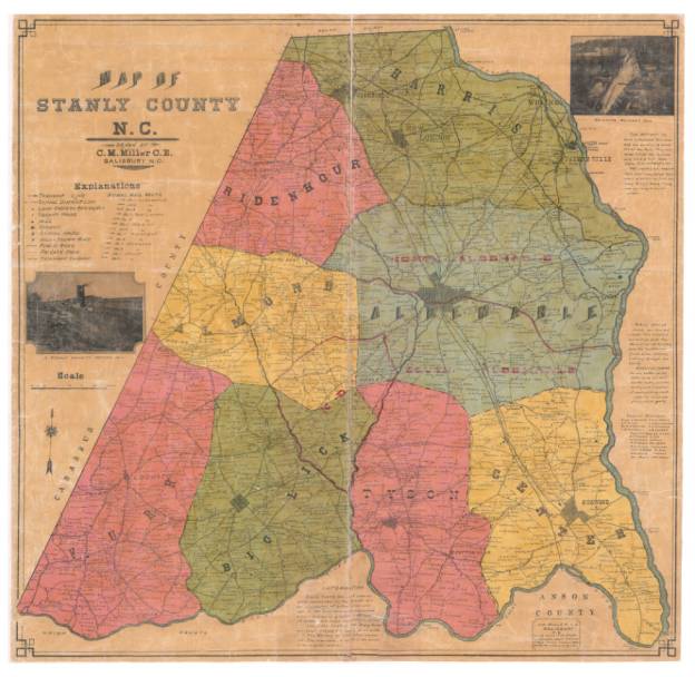
It’s a gray and dreary New Year’s day, so I’m kicked back, watching a bit of UNC Explorer TV and sharing memories with mom driven from the old 1905 map of Stanly County. There’s a Smyrna and Lymra church located near where Love’s Grove UMC now stands. And the Polk Ford road over to Love’s chapel crosses just above Chapel before passing by Clark’s Grove Baptist. And hey, in 1772 the route was likely the main highway from Charlotte to Elizabethtown!
I can also see my G-grandfather George Thomas’ home and store. I’ve heard old folks talk about him journeying to Charlotte by wagon to load up on goods to sell.
Take a look and wonder around a bit. Here’s the large searchable map of old Stanly County.
Can you find something you’ve always wondered about? Where did YOUR grandparents or great-grandparents live?

Thank you so much for the link to the map of old Stanly County. We have the maps like this of Rowan and Cabarrus, but have never seen Stanly. The link also took us to many other old maps that have been digitized.
Keep up the good work!