 When passing though administration, it was once customary for the surviving spouse of a deceased husband to receive a widow’s 1/3 right of all property as would have been determined by a court appointed committee. Another option, by way of writing a last will and testament, those who were passing were offered a nearly endless range of distribution possibilities. We know that per the wishes of the decedent, properties or any part therein were customarily given or lent to the widow until she too either passed or remarried. As for Joseph Thomas [II] who penned a last will and testament in1752 Bertie County, his initial wishes on such matters were quite clear:
Imprimus, I bequeath to my loving wife Ann Thomas the use or the plantation whereon I now live during her natural life and all the land thereunto belonging except what land lies on the south & southeast side of the plantation called the Spring Branch & also give to my sd. wife six cows and calves six sows & their pigs two breeding mares and as to my household furniture I lend the use of all to my sd. wife during her natural life and after her decease my will is that all of my sd. household goods be equally divided among my children share & share alike. I also lend to my sd. wife the use & labor of my negroes, she using them as they might to be used Viz; Rose, Jack, Boson until my children who I shall in this will give them to arrive to the age of twenty one years or the day of marriage or are capable to choose their guardians towards the raising my sd. children to her heirs or assignees.
Joseph Thomas [II] continued his directive by spelling out wishes for his named children: sons Michael, Josiah, Joseph; and daughters Mary and Elizabeth. Executors were wife Ann and loving friends Thomas Whitmell and Arthur Williams.
In this post, I’ll look closely at the family of Joseph Thomas [II] picking up on their story as Joseph’s life came to an end. We’ll look closely at legal records, Joseph’s last will and testament, and of events steering future descendants of this our family.
_______________________________________________
Joseph Thomas [II] penned his last will and testament on 26 Apr 1752. Some six years later, in Apr 1758, Joseph’s last will and testament was probated. Three months later, in Jul 1758, William Portis was appointed overseer of the road in the room of Joseph Thomas. Joseph had died and a person named Portis had stepped in to take his place in working the roads. And knowing that Joseph’s grandmother was Sussannah Portis I have to wonder if this coming together of names is merely coincidental?
Court estate records also in July indicate that “Ann Thomas [widow] and Arthur Williams Exors. of the last will and testament of Joseph Thomas deced moved the court for leave to sell so much of the perishable estate of the said deced as will pay and satisfy debts &c granted and ordered that the same be sold at publick vendue on the last Friday in August next at the late dwelling house of the said deced.” The estate inventory had been completed by John Sallis, a deputy sheriff (late of Bertie County).
The court also ordered that 7 pounds made from the estate sale be paid to Robert Harris, assignee of John Sallis. As John Sallis removed to Edgecombe County, it appears that Robert Harris had been ordered to take his place in administering the estate sale. Of interest here, Capt. John Hill paid the balance due …more on him later. Also in Aug 1758, Thomas Wilson late of Bertie was ordered to be brought in to pay a debt of ten pounds to the estate. Bondsmen: William Frazer and Jonathan Kittrell.
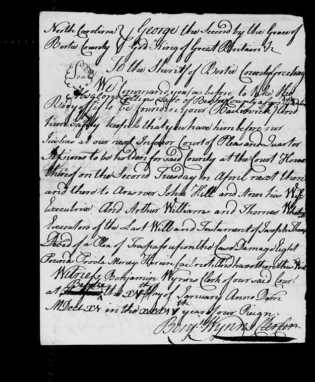
In Oct 1760, the courts ordered that Absolum Collins be brought in to answer a charge by “John Hill and Ann his wife (executrix) and Arthur Williams and Thomas Whitmell executors of the last will and testament of Joseph Thomas.” This may have something to do with a 1756 deed in which Joseph Thomas purchased land from James Davis [H-343, Bertie]. The transaction was witnessed by Absalom and Michael Collins. When sought by the court, the record shows that Absalom was “not to be found.”
Of crucial importance, the above estate record shows that two years after her husband’s last will and testament was probated, the widow Ann was now married to a person named John Hill. That’s a very important name in Bertie and is a person known to have had ties with both Thomas Whitmell and the Williams families who were named executors in Joseph Thomas [II]’s last will and testament. And remember the estate sale and the court ordering payment to Robert Harris who was assignee of John Sallis? The debt was paid by Col. John Hill.
When the spirits walk sometime they up and run. You can’t keep up with the ground needed to be plowed. And as good fortune would have it, my search at this time was about to be interrupted by another person whose solid understanding of the early days of Bertie County has been invaluable.
While at the main information desk seeking clarification on the organization of surviving records at North Carolina State Archives, a lady called out to me from across from the first work table in the research room. Asking, “did I hear you say Cashie, Tuscarora and Roanoke?,” it turns out that Gregory Tyler and I have much in common including having been coworkers within the Arts Programs at North Carolina State University. Following a short how-do, Gregory joined in on my quest and has been a great help. Thanks!
Now, looking back to Ann Thomas and John Hill, neither me nor Gregory knew anything about such a mix in families. To make this even more mysterious, it’s correctly believed that the very important Col. John Hill married second to Martha, the daughter of Thomas Whitmell who was co-executor of Joseph Thomas’ last will and testament! Did the widow Ann marry the Colonel? No ….as looking through tax lists the timing simply did not work. Thinking there must be a second John Hill, Gregory and I plowed the tax lists in which the deaths of Joseph Thomas and Col. John Hill were punctuated by entries for their widoes Ann Thomas and Martha [Whitmell] Hill. We searched high and low and found nothing in deeds or court records distinguishing Col. John Hill from this mystery person of same name.
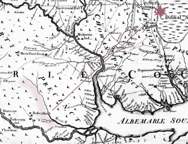
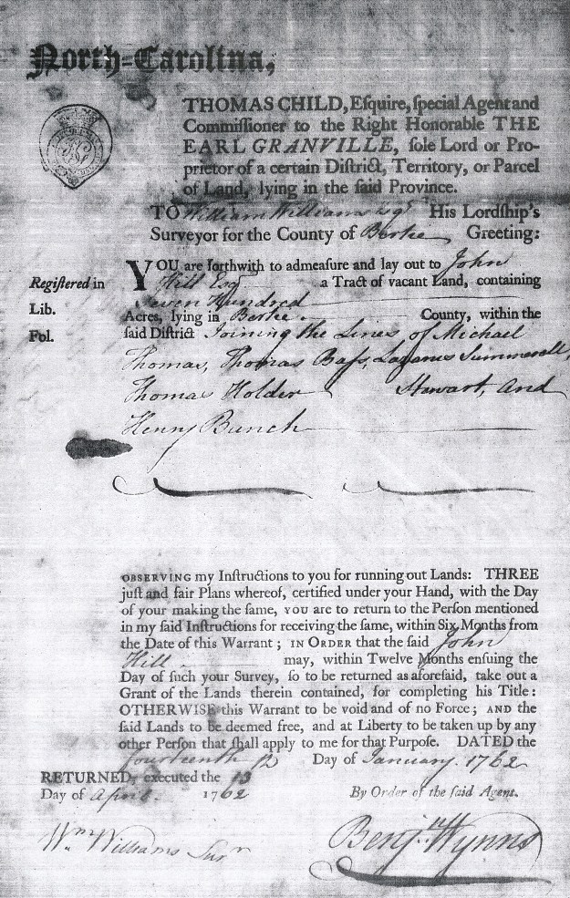
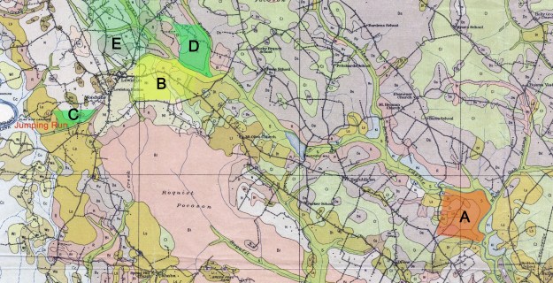
Knowing from deeds that John Hill received numerous Lord Granville grants, no mention of the records could be found in the card catalogue index for land grants. Going back to the information desk, I was pointed to yet another series that is searchable through MARS. These grants had never been merged with those records searchable in the card catalogue. Digging through the records I found about five grants in the name of Col. John Hill for grants “joining the lands belonging to the Tuscarora Indians & Roquest Swamp & Pocoson. And then, dated 12 Jun 1762, John Hill Esquire received a 700 acre grant “joining the lines of Michael Thomas, Thomas Bass, Lazarus Summerell, Thomas Holder, Steward and Henry Bunch” [image at top of page]. Going back through my records, I discovered a missed deed [K-283 Bertie, 24 Jun 1762] which further clarifies the same land: a Granville grant to John Hill Esq. “being 700 acres joining Cashie Swamp, Catherine Hunter, Robert West, Joseph Thomas, Hugh Bunch, Micajah Thomas, John Hill Jr., Whitmel Hill, sd. John Hill.”
The moral at this point is to search and document everything as now out of nowhere we’ve got the names of Whitmell Hill, Col. John Hill and a John Hill Junior all at the same place and time. We’re also seeing a genuine interaction with free people of color in the mentioning of Henry Bunch, Thomas Bass and others. Not only that, we have proximity to the Cashie Swamp, Joseph Thomas and to a Michael Thomas or is that a Micajah Thomas or yet two different people of same name?
I find nothing online for Ann and her second husband John Hill Junior. And so, at this point, I’m not going to get bogged down. I’m going to skip away to further records in search of Ann with focus being on her children. This must be an important time of change as Ann’s first husband died and she’s now remarried. Per Joseph Thomas’ last will and testament, her lands should now become the property of those of her children who had reached legal age. And for those who had not, the lands must have been held until they reached maturity. Also, are the children now living with mom and her new husband or will they be given right to choose a guardian of their choice? They are coming of age and some will marry. Some of their neighbors have moved and are now considered as living “late of Bertie.” Will any of Joseph and Ann’s children make the move away from the swamps of Bertie?


 I’d like to be able to paint a picture of my gggrandfather William“Bill” Bartlet Hinson with kind and loving language. But, he simply was not that kind of man. Known by many as “Fighting Bill”, William Bartlet Hinson was nothing less than hardcore. He served as constable in Union County where a case he was working on reached the Supreme Court. W. B Hinson, along with the Clontz brothers were charged with entering a dwelling at night in order to apprehend a person believed to be hiding out. Depositions tell of heavy handedness and of an equally harrowing experience. William Bartlet Hinson owned a sizeable farm situated on the east side of Highway 200 and north of Highway 218 in present day Union county. It is said he would stand at the nearby crossroads challenging to fight most anyone passing by. Back in the 1970’s, my cousin Linda Gail photographed Bill’s home which no longer stands (below).


 In 1729, Joseph Thomas deeded land on Oropeak Swamp in now Gates County to Samuel Bass. In return, Samuel Bass sold to the same Joseph Thomas land on Cashie River in neighboring Bertie County. Curious of any deeper family interactions, I came across the record of Nathaniel Bass. Likely a relative and possibly being Samuel’s great-grandfather,
 It was just three years before Joseph Thomas was awarded his headright on Orapeake Swamp when John Lawson was captured and killed by Tuscarora Indians while on an expedition with Christoph von Graffenried. The two were seeking the source of the Neuse River. John Lawson had journeyed across the back country where by 1709 he wrote his fabulous book titled
  Another timely event. Can you imagine life on the farm when all of a sudden a group of men stepped out of the swamp with axes, chains and lots of talk of cutting the state line through or near your land? That actually happened in 1728 when William Byrd II led another attempt to survey the state line. From William Byrd’s diary we get a glimpse of early life on the Oropeake Swamp:
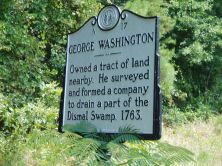 Other names also appearing in the above records include members of the Sumner family. In 1763, Fielding Lewis, George Washington’s brother in law,
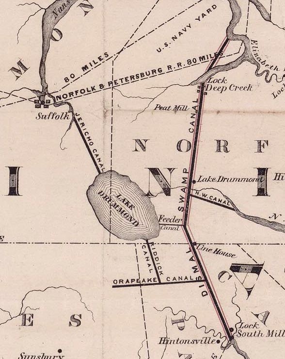


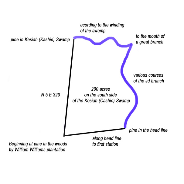
 Beyond the comparison of signature marks, there’s one other bit of evidence that links Joseph Thomas of Oropeak with Joseph Thomas who died ca. 1732-5 in Bertie. On the very same date as the sale from Joseph Thomas to Samuel Bass, Samuel Bass returned the favor by selling a tract of 200 acres to Joseph Thomas. Lying on the south side of the Kashie Swamp, metes and bounds for that transaction reads: