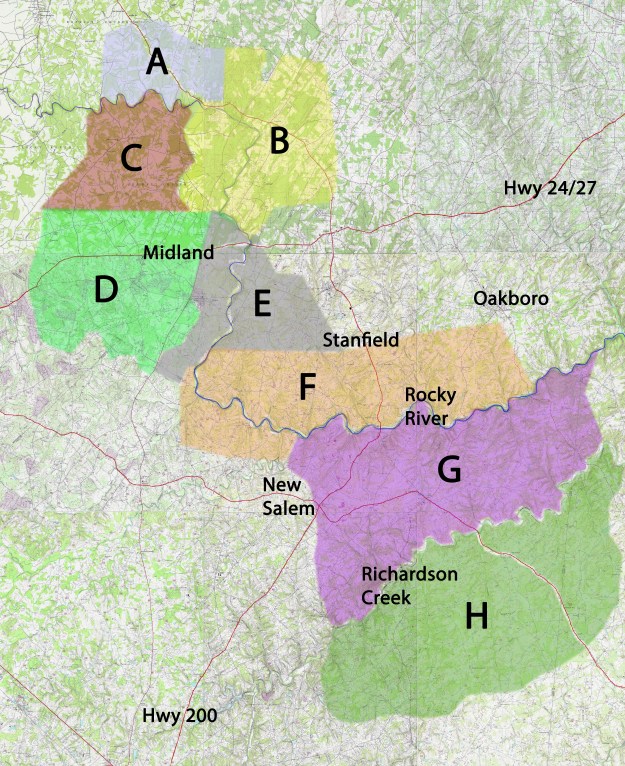
Index Map for Grants and Conveyances:
A. (LIGHT BLUE) – In Cabarrus, northwest of Rocky River.
B. (YELLOW) – In the big bend at the mouth of Dutch Buffalo Creek
C. (DARK RED) –West of Hwy 601 between Rocky Riverand Hwy 24/27
D. (BRIGHT GREEN) – west of Hwy 601 along and south of Hwy 24/27.
E. (GRAY) – Along the Rocky River south of 24/27 in Cabarrus and Stanly Counties.
F. (ORANGE) – In Stanly and Union Counties south of Stanfield – with plans to extend coverage eastward.
G. (PURPLE) – Between Rocky River and Richardson Creek in Union County – with plans to extend coverage eastward.
H. (DARKER GREEN) – South of Richardson Creek – with plans to extend coverage eastward.
___________________________________
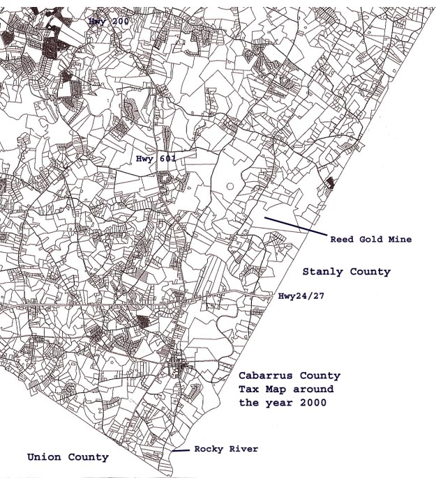
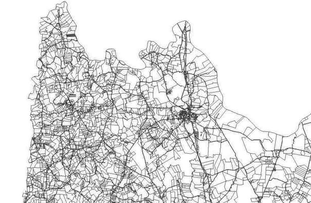
Over time land is bought and property tax maps become more cluttered making it difficult to locate and compare existing land boundaries to the original shapes of land grants. In a crude sense to preserve these old details, I’ve included several snapshots of related tax maps. I hope you’ll take time to compare the images below to what you see in the land grant maps above.
Cabarrus County tax map for year 2000:
Stanly County tax map for year 2005

Upper Anson County tax map for year 2018
George Thomas
6101 Ballou Court
Raleigh, North Carolina 27609
geothos@bellsouth.net
Copyright © 2009 by George G. Thomas
